 5:48
5:48
2025-03-04 20:16
 1:54:55
1:54:55
2026-05-03 21:00
 11:40:36
11:40:36
2026-04-30 00:01
 2:49:04
2:49:04
2026-04-23 12:28
 3:50:16
3:50:16
2024-08-19 15:47
 2:36:33
2:36:33
2026-04-24 17:06
 2:48:30
2:48:30
2023-12-23 12:24
 2:16:05
2:16:05
2025-01-18 21:00
 11:26:05
11:26:05
2026-04-30 00:01
 2:29:19
2:29:19
2025-10-01 19:29
 3:01:31
3:01:31
2025-10-02 19:15
 3:02:32
3:02:32
2023-12-23 12:08
 3:00:33
3:00:33
2025-04-06 21:40
 2:23:30
2:23:30
2025-10-09 18:53
 1:19:10
1:19:10
2025-10-17 14:49
 2:30:26
2:30:26
2025-10-09 19:14
 2:30:39
2:30:39
2023-12-23 12:22
 5:37:49
![AzaLi - Стерва (Премьера клипа 2026)]() 2:19
2:19
![Владимир Ждамиров - Купола, колокола (Премьера клипа 2026)]() 4:11
4:11
![Нурбек Махмудов - Кечир юрак (Премьера клипа 2026)]() 3:57
3:57
![BEARWOLF - Феникс (Премьера клипа 2026)]() 3:32
3:32
![Рейсан Магомедкеримов - Холостой (Премьера клипа 2026)]() 2:22
2:22
![Рейсан Магомедкеримов - Судьба связала (Премьера клипа 2026)]() 3:10
3:10
![Ислам Мальсуйгенов, Зульфия Чотчаева - Заиграла любовь (Премьера клипа 2026)]() 2:15
2:15
![ARTIX, Анна Калайчева - Под гипнозом (Премьера клипа 2026)]() 2:29
2:29
![Cvetocek7 - Неспокойно без тебя (Премьера клипа 2026)]() 2:34
2:34
![Гайратжон Янгибоев & Бонухон - Шахарда (Премьера клипа 2026)]() 3:15
3:15
![Винтаж - Малахит (Премьера клипа 2026)]() 3:44
3:44
![Пропаганда - Рейв (Премьера клипа 2026)]() 2:49
2:49
![Альберт Эркенов - По привычке (Премьера клипа 2026)]() 2:54
2:54
![Сакит Самедов - Королева (Премьера клипа 2026)]() 2:15
2:15
![Ислам Итляшев - Пиранья любовь (Премьера клипа 2026)]() 2:52
2:52
![Сергей Одинцов - Всю любовь тебе отдам (Премьера клипа 2026)]() 3:50
3:50
![Zhamil Turan - Танцуй (Премьера клипа 2026)]() 2:59
2:59
![AY YOLA - Aihylyu (Премьера клипа 2026)]() 3:49
3:49
![ARi SAM Vii - Я обиделась (Премьера клипа 2026)]() 2:45
2:45
![Альберт Эркенов - Непокорная (Премьера клипа 2026)]() 4:04
4:04
![Элла Маккей | Ella McCay (2025)]() 1:54:47
1:54:47
![Обитель зла: Возмездие | Resident Evil: Retribution (2012)]() 1:35:41
1:35:41
![Обитель зла: Последняя глава | Resident Evil: The Final Chapter (2016)]() 1:46:38
1:46:38
![Я иду искать 2 | Ready or Not 2: Here I Come (2026)]() 1:47:56
1:47:56
![Игра со смертью | Play Dead (2025)]() 1:12:23
1:12:23
![Обитель зла 3 | Resident Evil: Extinction (2010)]() 1:34:09
1:34:09
![Крик 7 | Scream 7 (2026)]() 1:53:59
1:53:59
![Супер Марио: Галактическое кино | The Super Mario Galaxy Movie (2026)]() 1:38:05
1:38:05
![Они придут за тобой | They Will Kill You (2026)]() 1:35:38
1:35:38
![Джо едет в колледж | Joe's College Road Trip (2026)]() 1:51:29
1:51:29
![Спрингстин. Избавь меня от небытия | Springsteen: Deliver Me from Nowhere (2025)]() 1:59:36
1:59:36
![Примат | Primate (2025)]() 1:32:12
1:32:12
![Грозовой перевал | Wuthering Heights (2026)]() 2:16:14
2:16:14
![Дьявол носит Prada 2 | The Devil Wears Prada 2 (2026)]() 1:51:51
1:51:51
![Аватар: Пламя и пепел | Avatar: Fire and Ash (2025)]() 3:17:14
3:17:14
![Частная жизнь | Vie privée (2025)]() 1:47:21
1:47:21
![Нескромные | Splitsville (2025)]() 1:44:43
1:44:43
![Вершина | Apex (2026)]() 1:35:30
1:35:30
![Хищный рывок | Thrash (2026)]() 1:26:13
1:26:13
![Восстание зловещих мертвецов | Evil Dead Rise (2023)]() 1:36:30
1:36:30
![Забавные медвежата]() 13:00
13:00
![Сборники «Оранжевая корова»]() 1:05:17
1:05:17
![Приключения Пети и Волка]() 11:00
11:00
![Пип и Альба Сезон 1]() 11:02
11:02
![Герой внутри]() 1:09
1:09
![Ну, погоди! Каникулы]() 7:09
7:09
![Панда и петушок Лука]() 12:12
12:12
![Отважные мишки]() 13:00
13:00
![Майло]() 0:25
0:25
![Простоквашино. Финансовая грамотность]() 3:27
3:27
![Лудлвилль]() 7:05
7:05
![Отряд А. Игрушки-спасатели]() 13:06
13:06
![Роботы-пожарные]() 12:31
12:31
![Зомби Дамб]() 5:14
5:14
![Енотки]() 7:08
7:08
![Космический рейнджер Роджер Сезон 1]() 11:32
11:32
![Папа Супергерой Сезон 1]() 4:28
4:28
![Рэй и пожарный патруль Сезон 1]() 13:27
13:27
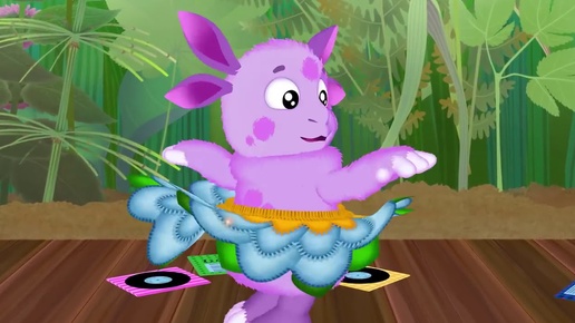
![Люк - путешественник во времени]() 1:19:50
1:19:50
![Мотофайтеры]() 13:10
13:10
![Лучшие в Аду (2022)]() 1:49:08
1:49:08
![КАМИН 4К 🔥 FIREPLACE 4K | Звуки камина и Треск огня]() 2:00:00
2:00:00
![Смешарики (большой сборник)]() 3:25:27
3:25:27
![Три Кота 🐱 Сборник серий подряд | Смотреть онлайн развивающие мультики и игры для детей и малышей]() 3:16:51
3:16:51
![Штрафбат(1-11 серии) HD 2004]() 8:05:56
8:05:56
![мультфильм «Ну, погоди!» (1-16 серии)]() 2:31:36
2:31:36
![Форсаж 6 | Furious 6 (2013)]() 2:11:07
2:11:07
![Маша и Медведь. Серия 1. Первая встреча]() 6:36
6:36
![Аватар 3: Пламя и пепел фильм, 2025]() 3:09:06
3:09:06
![Максим ФАДЕЕВ feat. Григорий ЛЕПС - Орлы или вороны ft.и]() 4:38
4:38
![Jazzdauren - Дарите женщинам цветы]() 3:09
3:09
![Мир в огне (все серии) 4K]() 12:26:36
12:26:36
![Лунтик | Танцы 💃💃💃 Сборник мультиков для детей]() 46:30
46:30
![Алдан (2025)]() 1:38:04
1:38:04
![_*ДискотекА 80-90х ВиДео АлЬбом Лучшие.*_]() 2:40:60
2:40:60
![Форсаж 9 | F9 (2021)]() 2:22:56
2:22:56
![Зверополис | Zootopia (2016)]() 1:48:48
1:48:48
![Дева и дракон | Damsel (2024)]() 1:49:38
1:49:38
![Снова в деле (2025) Netflix]() 1:54:23
1:54:23
![Клипы 90-х. Русский сборник хитов]() 1:29:27
1:29:27
5:37:49

Скачать Видео с Рутуба по ссылке
| 256x144 | ||
| 640x360 | ||
| 1280x720 | ||
| 1920x1080 |
 2:19
2:19
2026-04-23 11:42
 4:11
4:11
2026-04-17 12:33
 3:57
3:57
2026-04-20 16:53
 3:32
3:32
2026-04-15 12:36
 2:22
2:22
2026-04-11 10:26
 3:10
3:10
2026-04-29 11:37
 2:15
2:15
2026-04-17 12:38
 2:29
2:29
2026-04-28 10:53
 2:34
2:34
2026-04-23 11:07
 3:15
3:15
2026-04-20 17:02
 3:44
3:44
2026-04-28 12:53
 2:49
2:49
2026-04-17 12:23
 2:54
2:54
2026-04-29 11:48
 2:15
2:15
2026-04-12 11:24
 2:52
2:52
2026-04-23 10:50
 3:50
3:50
2026-04-21 10:41
 2:59
2:59
2026-04-15 12:45
 3:49
3:49
2026-04-20 16:46
 2:45
2:45
2026-04-12 10:21
 4:04
4:04
2026-04-10 10:01
0/0
 1:54:47
2026-02-11 21:47
 1:35:41
2026-02-25 19:41
 1:46:38
2026-02-25 19:41
 1:47:56
2026-04-12 17:20
 1:12:23
2026-03-06 18:16
 1:34:09
2026-02-25 19:41
 1:53:59
2026-04-22 11:21
 1:38:05
2026-04-12 21:37
 1:35:38
2026-05-04 16:23
 1:51:29
2026-02-26 14:41
 1:59:36
2026-02-13 14:02
 1:32:12
2026-02-17 21:38
 2:16:14
2026-04-20 11:54
 1:51:51
2026-05-06 10:53
 3:17:14
2026-04-02 11:34
 1:47:21
2026-04-09 22:40
 1:44:43
2026-04-09 22:40
 1:35:30
2026-04-30 16:00
 1:26:13
2026-04-29 20:33
 1:36:30
2026-05-06 14:10
0/0
 13:00
13:00
2024-12-02 13:15
 1:05:17
2025-07-15 11:22
 11:00
11:00
2022-04-01 17:59
2021-09-22 23:37
 1:09
1:09
2026-04-03 12:21
 7:09
7:09
2026-04-11 10:00
 12:12
12:12
2024-11-29 14:21
 13:00
13:00
2024-11-29 13:39
 0:25
0:25
2026-04-10 13:19
 3:27
3:27
2024-12-07 11:00
 7:05
7:05
2025-12-30 20:49
 13:06
13:06
2024-11-28 16:30
2021-09-23 00:12
 5:14
5:14
2024-11-28 13:12
 7:08
7:08
2025-12-30 21:34
2021-09-22 21:49
2021-09-22 21:52
2021-09-22 23:51
 1:19:50
2024-12-17 16:00
 13:10
13:10
2024-11-27 14:57
0/0
 1:49:08
2022-10-20 11:01
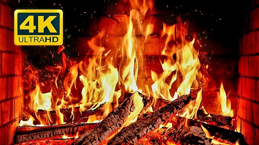 2:00:00
2024-12-19 00:00
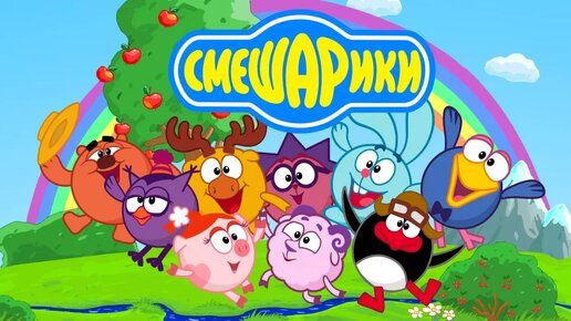 3:25:27
2025-01-24 05:04
 3:16:51
2025-10-03 19:48
 8:05:56
2017-07-08 19:33
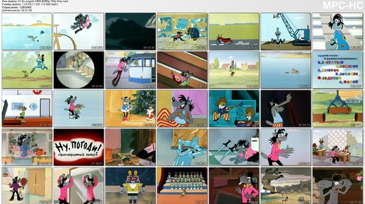 2:31:36
2024-12-06 21:59
 2:11:07
2023-04-25 22:52
2015-02-06 15:18
 3:09:06
2025-12-26 16:56
 4:38
4:38
2017-12-19 08:20
 3:09
3:09
2024-05-30 14:13
 12:26:36
2025-11-14 19:42
 46:30
46:30
2024-08-05 22:22
 1:38:04
2026-03-26 23:45
 2:40:60
2024-03-18 17:25
 2:22:56
2023-04-25 23:06
 1:48:48
2024-12-16 19:01
 1:49:38
2024-03-12 00:19
 1:54:23
2025-01-18 20:05
 1:29:27
2024-01-12 11:40
0/0