 1:25
1:25
2024-04-12 05:58
 2:36
2:36
2:36
2024-04-18 20:30
 1:04
1:04
1:04
2024-08-15 21:05
 1:45
1:45
1:45
2024-12-04 09:30
 6:58
6:58
6:58
2024-04-09 12:19
 18:54
18:54
18:54
2023-11-15 06:47
 18:08
18:08
18:08
2025-03-13 14:38
 1:23
1:23
1:23
2023-12-10 00:54
 4:31
4:31
4:31
2024-05-03 11:47
 3:00
3:00
3:00
2023-10-28 12:08
 0:27
0:27
0:27
2023-12-20 08:45
 6:10
6:10
6:10
2022-02-18 13:34
 0:43
0:43
0:43
2023-09-19 12:48
 2:23
2:23
2:23
2023-08-22 12:19
 1:00:45
1:00:45
2023-04-15 01:20
 3:15
3:15
3:15
2023-09-05 11:37
 9:35
9:35
9:35
2023-10-05 15:09
 4:04
4:04
![Премьера клипа! Дима Билан - Что то на родном]() 3:38
3:38
![Премьера клипа! Стас Костюшкин и Настасья Самбурская - «Невеста»]() 2:37
2:37
![Премьера клипа! Мари Краймбрери – Сегодня мой лучший день]() 3:10
3:10
![Премьера клипа! NECHAEV - Скучаю по тебе]() 2:49
2:49
![Премьера клипа! BITTUEV - Я ВСЕ СКАЗАЛ]() 2:44
2:44
![Премьера клипа! Roza Zergerli - Одинокая]() 2:22
2:22
![Премьера клипа! Kamazz и Валерия feat. Red Square - Зеркала]() 3:00
3:00
![Премьера клипа! ПАРОДА - Скажешь мне да]() 3:38
3:38
![Премьера клипа! Миша Житов – ПОДСЕЛ]() 2:37
2:37
![Премьера! 3-ий Январь и IL'GIZ - Дорога дальняя]() 2:44
2:44
![Премьера клипа! ARTIK & ASTI - Модный Поп]() 3:12
3:12
![Премьера клипа! Ленинград — Бешеный фэшн]() 2:52
2:52
![Премьера клипа! Люся Чеботина - Каблук]() 3:15
3:15
![Премьера клипа! Лизогуб и Amirchik - Неуловимая]() 2:26
2:26
![Премьера! Джиган и NILETTO ft. Loc-Dog - Дорого (LIVE)]() 2:37
2:37
![Премьера клипа! Инна Вальтер - С козырей зашёл]() 3:31
3:31
![Премьера клипа! AY YOLA - Ugez]() 3:53
3:53
![Премьера клипа! Ани Лорак — Такси]() 3:22
3:22
![Премьера клипа! ANIVAR - ТАКСИ]() 3:02
3:02
![Премьера клипа! Егор Крид - Одиноко]() 2:16
2:16
![Война между людьми и ИИ. Серия 10]() 20:36
20:36
![Война между людьми и ИИ. Серия 8]() 19:19
19:19
![Плохой Cанта 2 | Bad Santa 2 (2016) (Гоблин)]() 1:28:32
1:28:32
![Война между людьми и ИИ. Серия 11]() 18:53
18:53
![Некая справедливость (2014)]() 1:32:52
1:32:52
![Отец]() 1:32:56
1:32:56
![Легенды: Гробница дракона (2013)]() 1:32:30
1:32:30
![Ниже нуля (2021) Netflix]() 1:46:35
1:46:35
![Финикийская схема (2025)]() 1:41:00
1:41:00
![Терминатор 2: Судный день | Terminator 2: Judgment Day (1991) (Гоблин)]() 2:36:13
2:36:13
![Тот самый | Him (2025)]() 1:36:20
1:36:20
![Порочный круг | Vicious (2025)]() 1:42:30
1:42:30
![Стив (2025)]() 1:33:30
1:33:30
![101 далматинец: Все части 1, 2 (фильмы)]() 3:46:00
3:46:00
![Война между людьми и ИИ. Серия 7]() 18:32
18:32
![Последний клиент]() 1:33:23
1:33:23
![Шафер напрокат (2015)]() 1:41:27
1:41:27
![Война между людьми и ИИ. Серия 9]() 18:53
18:53
![Токсичный мститель (2023)]() 1:42:11
1:42:11
![Алиса в Стране чудес: Все части 1, 2 (фильмы)]() 4:14:09
4:14:09
![Земля до начала времён 13: Сила дружбы (2007) / The Land Before Time XIII]()
 1:15:39
![Науэль и волшебная книга (2020) / Nauel and the Magic Book]()
 1:37:06
![Упс… Ной уплыл! (2015) / Ooops! Noah Is Gone...]()
 1:26:28
![Дорога домой (2021) / Back to the Outback]()
 1:31:40
![Альфа и Омега 3: Большие Волчьи Игры (2013) / Alpha and Omega 3: The Great Wolf Games]()
 45:01
45:01
![Земля до начала времён 10: Великая миграция (2003) / The Land Before Time X]()
 1:24:21
![Смурфики (2011) / The Smurfs]()
 1:42:44
![Иллюзионист (2010) / L'illusionniste]()
 1:19:53
![ЛЕГО Манки Кид: Рождение героя (2020) / Lego Monkie Kid: A Hero Is Born]()
 45:00
45:00
![Плохие парни 2 (2025) / The Bad Guys 2]()
 1:43:47
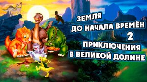
![Земля до начала времён 2: Приключения в Великой Долине (1994) / The Land Before Time II]()
 1:13:31
![Волшебный парк Джун (2019) / Wonder Park]()
 1:25:17
![Союз зверей (2010) / Animals United]()
 1:33:07
![Барби: Виртуальный мир (2017) / Barbie Video Game Hero]()
 1:12:19
![Девочки из Эквестрии. Легенды вечнозелёного леса (2016) / Equestria Girls. Legend of Everfree]()
 1:13:14
![Земля до начала времён 3: В поисках воды (1995) / The Land Before Time III]()
 1:10:48
![Эти прекрасные мультяшки: Рождественский выпуск (1992) / It's a Wonderful Christmas Special]()
 22:22
22:22
![Земля до начала времён 5: Таинственный остров (1997) / The Land Before Time V]()
 1:13:30
![Земля до начала времён 11: Вторжение Мышезавров (2005) / The Land Before Time XI]()
 1:20:52
![Девочки из Эквестрии. Пропуск за кулисы для Сансет (2018) / Equestria Girls. Sunset's Backstage Pass]()
 44:08
44:08
4:04

Скачать видео
| 426x240 | ||
| 640x360 | ||
| 854x480 | ||
| 1280x720 |
 3:38
3:38
2025-09-22 14:44
 2:37
2:37
2025-09-02 11:35
 3:10
3:10
2025-09-26 10:45
 2:49
2:49
2025-10-03 12:00
 2:44
2:44
2025-09-28 17:42
 2:22
2:22
2025-09-28 17:46
 3:00
3:00
2025-09-12 13:18
 3:38
3:38
2025-09-02 10:34
 2:37
2:37
2025-08-05 22:35
 2:44
2:44
2025-08-26 15:20
 3:12
3:12
2025-08-15 11:43
 2:52
2:52
2025-09-06 13:15
 3:15
3:15
2025-09-17 21:08
 2:26
2:26
2025-08-05 17:07
 2:37
2:37
2025-09-17 08:58
2025-09-30 09:56
 3:53
3:53
2025-09-06 15:26
 3:22
3:22
2025-08-24 08:24
 3:02
3:02
2025-09-29 21:09
 2:16
2:16
2025-08-25 16:04
0/0
2025-10-15 10:25
2025-10-15 10:25
 1:28:32
2025-10-07 09:27
2025-10-15 10:26
2025-10-13 04:45
 1:32:56
2025-10-13 11:37
2025-10-10 08:28
 1:46:35
2025-10-14 21:34
 1:41:00
2025-10-05 21:22
 2:36:13
2025-10-07 09:27
 1:36:20
2025-10-09 20:02
 1:42:30
2025-10-14 20:27
 1:33:30
2025-10-05 21:21
 3:46:00
2025-10-14 19:14
2025-10-15 10:25
 1:33:23
2025-10-13 11:36
 1:41:27
2025-10-14 22:27
2025-10-15 10:25
 1:42:11
2025-10-14 21:50
 4:14:09
2025-10-06 16:06
0/0
1:15:39
2025-10-06 18:00
1:37:06
2025-10-05 18:00
1:26:28
2025-09-06 18:00
1:31:40
2025-09-12 18:00
45:01
2025-10-10 18:00
1:24:21
2025-09-30 18:00
1:42:44
2025-09-27 18:00
1:19:53
2025-10-11 18:00
45:00
2025-10-07 18:00
1:43:47
2025-09-23 18:00
1:13:31
2025-09-13 18:00
1:25:17
2025-09-08 18:00
1:33:07
2025-10-15 18:01
1:12:19
2025-09-05 18:00
1:13:14
2025-10-01 18:00
1:10:48
2025-09-15 18:00
22:22
2025-09-11 18:00
1:13:30
2025-09-20 18:00
1:20:52
2025-10-02 18:00
44:08
Девочки из Эквестрии. Пропуск за кулисы для Сансет (2018) / Equestria Girls. Sunset's Backstage Pass
2025-10-03 18:00
0/0