 10:23
10:23
2024-12-20 16:18
 11:06
11:06
11:06
2024-08-12 12:23
 13:06
13:06
13:06
2025-09-19 03:50
 1:11
1:11
1:11
2025-09-22 05:01
 2:32
2:32
2:32
2025-08-26 08:30
 5:54
5:54
5:54
2025-09-21 11:00
 11:47
11:47
11:47
2025-09-15 14:52
 6:35
6:35
6:35
2025-09-11 19:58
 6:14
6:14
6:14
2025-08-22 09:00
 13:20
13:20
13:20
2025-09-03 21:34
 41:08
41:08
41:08
2025-09-26 10:59
 13:29
13:29
13:29
2025-09-23 15:27
 2:52
2:52
2:52
2025-09-18 18:40
 0:27
0:27
0:27
2025-09-23 20:02
 57:51
57:51
57:51
2025-09-26 11:07
 5:59
5:59
5:59
2025-09-25 00:30
 55:20
55:20
55:20
2025-09-26 19:00
 23:01
23:01
![Премьера клипа! Стас Костюшкин и Настасья Самбурская - «Невеста»]() 2:37
2:37
![Премьера! Джиган и NILETTO ft. Loc-Dog - Дорого (LIVE)]() 2:37
2:37
![Премьера клипа! GAYAZOV$ BROTHER$ – Выбираю море]() 3:12
3:12
![Премьера клипа! ДжаЯмми - Вива!]() 3:00
3:00
![Премьера клипа! Артур Пирожков и Элвин Грей - Женщина-Магнит]() 3:13
3:13
![Премьера клипа! NEMIGA, NAVAI - Пойдем в кино]() 2:47
2:47
![Премьера клипа! Лизогуб и Amirchik - Неуловимая]() 2:26
2:26
![Премьера клипа! Мари Краймбрери – Сегодня мой лучший день]() 3:10
3:10
![Премьера клипа! ARTEE - А я так жду]() 3:23
3:23
![Премьера клипа! Ленинград — Бешеный фэшн]() 2:52
2:52
![Премьера клипа! BITTUEV - Я ВСЕ СКАЗАЛ]() 2:44
2:44
![Премьера клипа! ANIVAR - ТАК И НЕ ПОНЯЛ]() 2:37
2:37
![Премьера клипа! ARTIK & ASTI - Модный Поп]() 3:12
3:12
![Премьера клипа! BEARWOLF - Ястребы (OST «Этерна»)]() 2:26
2:26
![Премьера клипа! Джиган и NILETTO, Loc-Dog - Дорого]() 2:41
2:41
![Премьера клипа! ХАБИБ - Шаганэ]() 2:49
2:49
![DJ БлокNote - Ночь, Улица, фонарь, Аптека]() 2:09
2:09
![Миша Хорев - Лилии]() 3:02
3:02
![Премьера! 3-ий Январь и IL’GIZ - Дорога дальняя]() 2:44
2:44
![Премьера клипа! Анастасия Сотникова - Первая любовь]() 2:37
2:37
![не14]() 1:32:52
1:32:52
![Скелеты Железного острова]() 1:25:19
1:25:19
![Порочный круг (2025)]() 1:43:41
1:43:41
![Хитмэн (2007) (Расширенная версия)]() 1:34:14
1:34:14
![Пойман с поличным | Caught Stealing (2025)]() 1:46:45
1:46:45
![Комната (2003)]() 1:39:52
1:39:52
![Добыча (2022)]() 1:45:08
1:45:08
![Тот самый | Him (2025)]() 1:36:20
1:36:20
![Французский любовник | French Lover (2025)]() 2:02:20
2:02:20
![Грязная игра | Play Dirty (2025)]() 2:07:36
2:07:36
![Терминатор | The Terminator (1984) (Гоблин)]() 1:47:17
1:47:17
![Стив | Steve (2025)]() 1:33:34
1:33:34
![Отец]() 1:32:56
1:32:56
![Стив (2025)]() 1:33:30
1:33:30
![Гонка (2013) 1080]() 1:37:04
1:37:04
![Миссия невыполнима: Финальная расплата (2025)]() 2:52:55
2:52:55
![Школьный автобус (2025)]() 2:09:51
2:09:51
![Мужчина у меня в подвале | The Man in My Basement (2025)]() 1:54:48
1:54:48
![Битва проклятых (2013)]() 1:28:46
1:28:46
![Хищник | Predator (1987) (Гоблин)]() 1:46:40
1:46:40
![Земля до начала времён 5: Таинственный остров (1997) / The Land Before Time V]()
 1:13:30
![Земля до начала времён 4: Путешествие в Землю Туманов (1996) / The Land Before Time IV]()
 1:13:52
![Земля до начала времён 7: Камень Холодного Огня (2000) / The Land Before Time VII]()
 1:14:10
![Иллюзионист (2010) / L'illusionniste]()
 1:19:53
![Девочки из Эквестрии. Легенды вечнозелёного леса (2016) / Equestria Girls. Legend of Everfree]()
 1:13:14
![Барби: Скиппер и большое приключение с детьми (2023) / Skipper and the Big Babysitting Adventure]()
 1:02:58
![Жил-был кот (2016) / Rudolf The Black Cat]()
 1:27:45
![Земля до начала времён 13: Сила дружбы (2007) / The Land Before Time XIII]()
 1:15:39
![Шерлок Гномс (2018) / Sherlock Gnomes]()
 1:26:19
![Земля до начала времён 11: Вторжение Мышезавров (2005) / The Land Before Time XI]()
 1:20:52
![Альфа и Омега 2: Приключения праздничного воя (2013) / Alpha and Omega 2: A Howl-iday Adventure]()
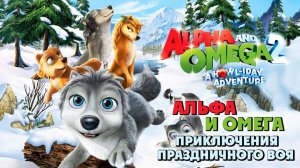 45:08
45:08
![Барби: Виртуальный мир (2017) / Barbie Video Game Hero]()
 1:12:19
![Ночная жуть Тайни Тун (1995) / Tiny Toon Night Ghoulery]()
 43:38
43:38
![Земля до начала времён 12: Великий День птиц (2006) / The Land Before Time XII]()
 1:20:30
![Альфа и Омега 4: Легенда о Зубастой Пещере (2014) / Alpha and Omega 4]()
 45:14
45:14
![Земля до начала времён 10: Великая миграция (2003) / The Land Before Time X]()
 1:24:21
![Гномео и Джульетта (2011) / Gnomeo & Juliet]()
 1:23:51
![Барби и её сёстры в поисках щенков (2016) / Barbie & Her Sisters in a Puppy Chase]()
 1:15:20
![Земля до начала времён 6: Тайна Скалы Динозавров (1998) / The Land Before Time VI]()
 1:12:60
![Земля до начала времён 9: Путешествие к Большой Воде (2002) / The Land Before Time IX]()
 1:14:38
23:01
Скачать видео
| 256x144 | ||
| 640x360 | ||
| 1280x720 | ||
| 1920x1080 |
 2:37
2:37
2025-09-02 11:35
 2:37
2:37
2025-09-17 08:58
 3:12
3:12
2025-08-10 17:27
 3:00
3:00
2025-08-15 12:03
 3:13
3:13
2025-09-19 18:07
 2:47
2:47
2025-10-10 09:59
 2:26
2:26
2025-08-05 17:07
 3:10
3:10
2025-09-26 10:45
 3:23
3:23
2025-08-23 11:31
 2:52
2:52
2025-09-06 13:15
 2:44
2:44
2025-09-28 17:42
 2:37
2:37
2025-09-07 15:55
 3:12
3:12
2025-08-15 11:43
 2:26
2:26
2025-08-21 09:28
 2:41
2:41
2025-08-22 19:10
 2:49
2:49
2025-10-10 09:59
 2:09
2:09
2025-08-16 22:41
2025-10-02 12:16
 2:44
2:44
2025-09-13 14:31
 2:37
2:37
2025-09-02 11:35
0/0
2025-10-13 04:45
 1:25:19
2025-10-13 11:18
 1:43:41
2025-10-13 12:39
 1:34:14
2025-10-13 21:11
 1:46:45
2025-10-02 20:45
 1:39:52
2025-10-08 18:11
 1:45:08
2025-10-06 12:51
 1:36:20
2025-10-09 20:02
 2:02:20
2025-10-01 12:06
 2:07:36
2025-10-02 20:46
 1:47:17
2025-10-07 09:28
 1:33:34
2025-10-08 12:27
 1:32:56
2025-10-13 11:37
 1:33:30
2025-10-05 21:21
2025-10-05 17:38
 2:52:55
2025-10-05 20:57
 2:09:51
2025-10-04 10:38
 1:54:48
2025-10-01 15:17
2025-10-03 22:51
 1:46:40
2025-10-07 09:27
0/0
1:13:30
2025-09-20 18:00
1:13:52
2025-09-17 18:00
1:14:10
2025-09-24 18:00
1:19:53
2025-10-11 18:00
1:13:14
2025-10-01 18:00
1:02:58
2025-09-07 18:00
1:27:45
2025-09-04 18:00
1:15:39
2025-10-06 18:00
1:26:19
2025-09-25 18:00
1:20:52
2025-10-02 18:00
45:08
2025-10-08 18:00
1:12:19
2025-09-05 18:00
43:38
2025-09-09 18:00
1:20:30
2025-10-04 18:00
45:14
2025-10-12 18:00
1:24:21
2025-09-30 18:00
1:23:51
2025-09-10 18:00
1:15:20
2025-09-03 18:00
1:12:60
2025-09-22 18:01
1:14:38
2025-09-28 18:00
0/0